


Login or Signup
Please enter a valid mobile number
A 6-digit OTP will be shared with your mobile number
6-digit OTP will be sent to this email
OTP verification
Please enter OTP sent to (+)
Please enter OTP sent to email
Incorrect OTP
Resend OTP
Personal Details
Please Enter First Name
Please enter Last Name
Please enter Valid Email ID
Enter Valid Mobile Number
Please accept the terms and conditions
By checking this box, you agree to let us use your information
to communicate with you through E-mails, texts and calls for
providing our product or service related information for
promotional purposes. The information will be secured as per our
privacy policy.
PLEASE READ THIS ROYAL ENFIELD MOBILE APPLICATION END-USER LICENSE AGREEMENT (HEREINAFTER REFERRED TO AS “EULA”) CAREFULLY BEFORE REGISTERING OR USING “ROYAL ENFIELD” MOBILE APPLICATION SERVICES.
This EULA forms a binding legal agreement between you (“You” or
“Your”) and Eicher Motors Limited, known by its brand name Royal
Enfield (each separately a “Party” and collectively the “Parties”)
as of the date You download the Mobile App (defined hereinafter).
This EULA shall apply to Your use of the Royal Enfield mobile
application and services (“Mobile App”) provided by Eicher Motors
Limited (hereinafter referred to as “EML”, “Royal Enfield” or
“RE”).
This EULA forms a binding legal agreement between you (“You” or
“Your”) and Eicher Motors Limited, known by its brand name Royal
Enfield (each separately a “Party” and collectively the “Parties”)
as of the date You download the Mobile App (defined hereinafter).
This EULA shall apply to Your use of the Royal Enfield mobile
application and services (“Mobile App”) provided by Eicher Motors
Limited (hereinafter referred to as “EML”, “Royal Enfield” or
“RE”). This EULA only This EULA forms a binding legal agreement
between you (“You” or “Your”) and Eicher Motors Limited, known by
its brand name Royal Enfield (each separately a “Party” and
collectively the “Parties”) as of the date You download the Mobile
App (defined hereinafter). This EULA shall apply to Your use of
the Royal Enfield mobile application and services (“Mobile App”)
provided by Eicher Motors Limited (hereinafter referred to as
“EML”, “Royal Enfield” or “RE”). This EULA only This EULA forms a
binding legal agreement between you (“You” or “Your”) and Eicher
Motors Limited, known by its brand name Royal Enfield (each
separately a “Party” and collectively the “Parties”) as of the
date You download the Mobile App (defined hereinafter). This EULA
shall apply to Your use of the Royal Enfield mobile application
and services (“Mobile App”) provided by Eicher Motors Limited
(hereinafter referred to as “EML”, “Royal Enfield” or “RE”). This
EULA only
User not found
Your Country has been changed to
Select Country
Global
Asia Pacific


Europe


Americas
Middle East & Africa


Your Country has been changed to Canada


Overview
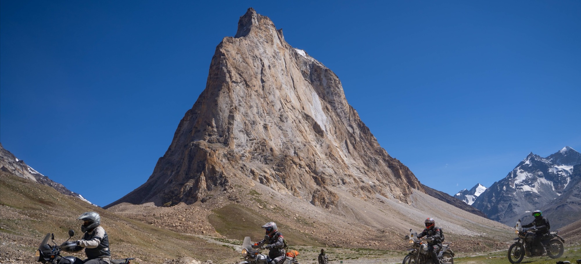
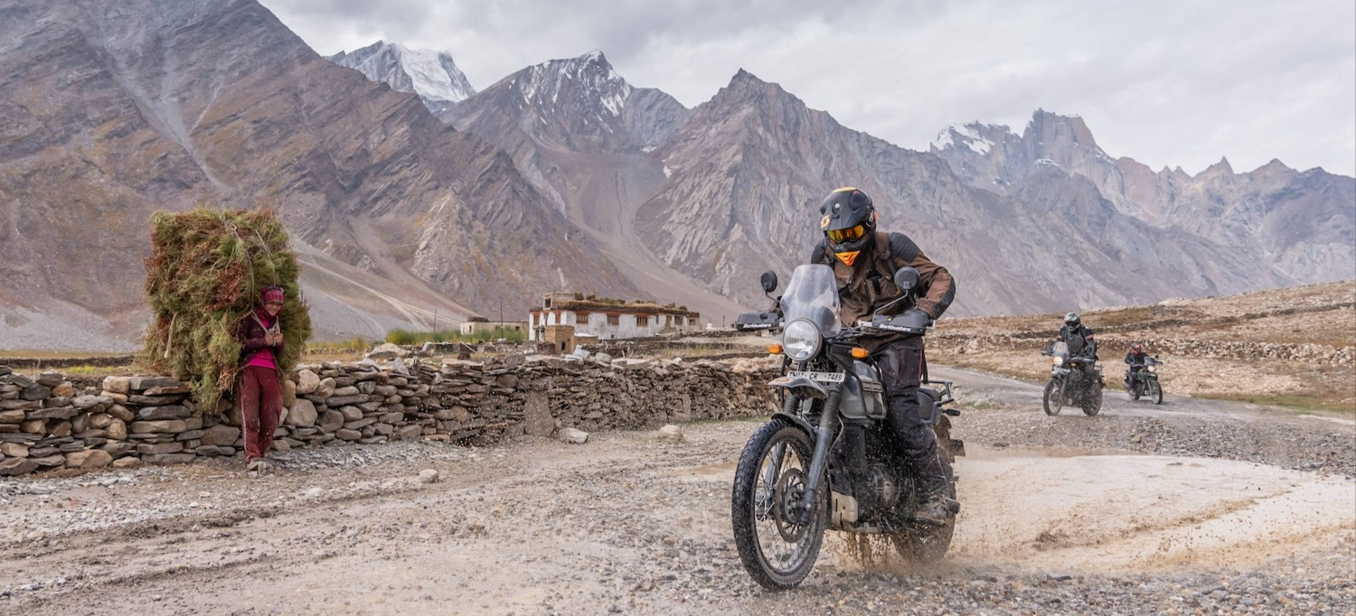
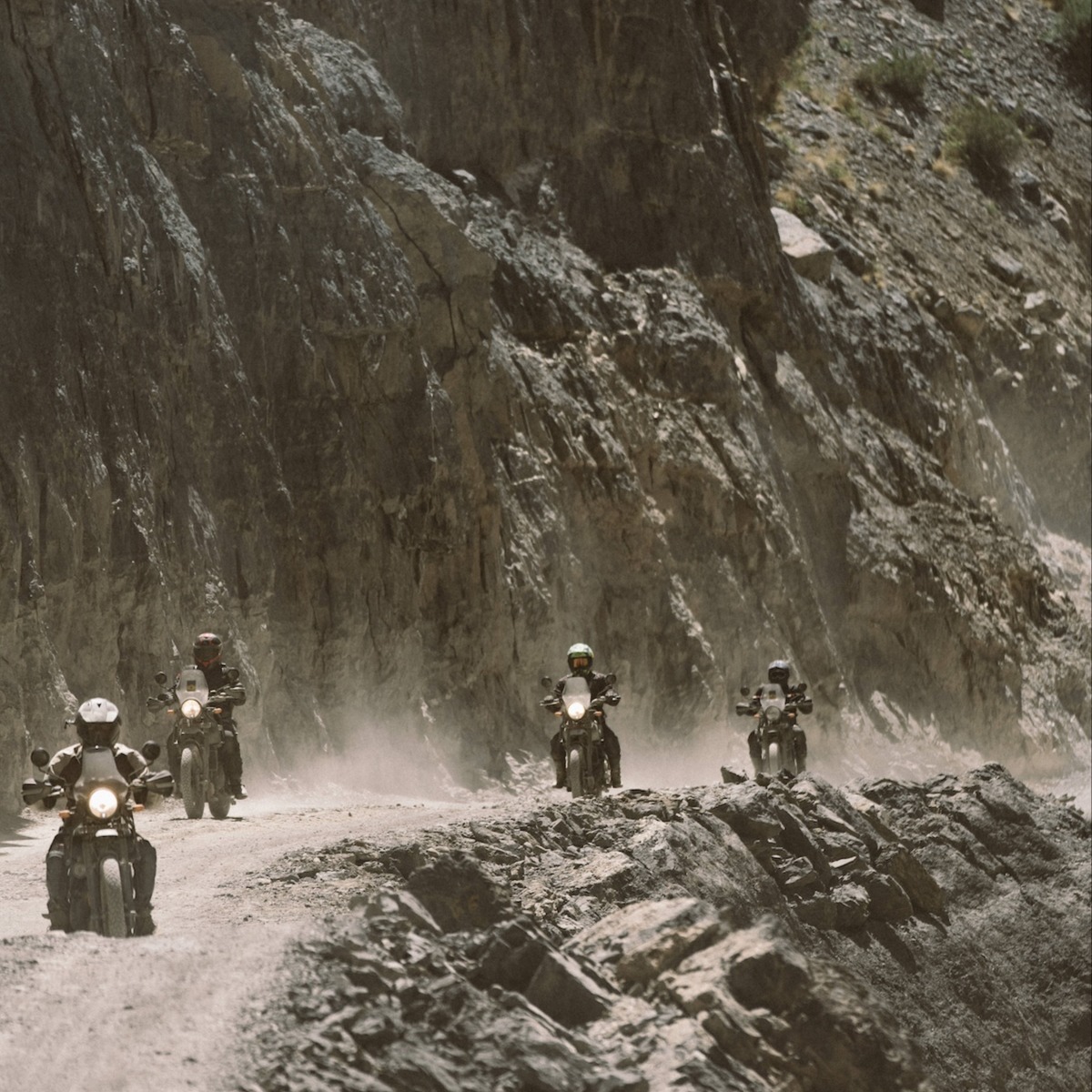
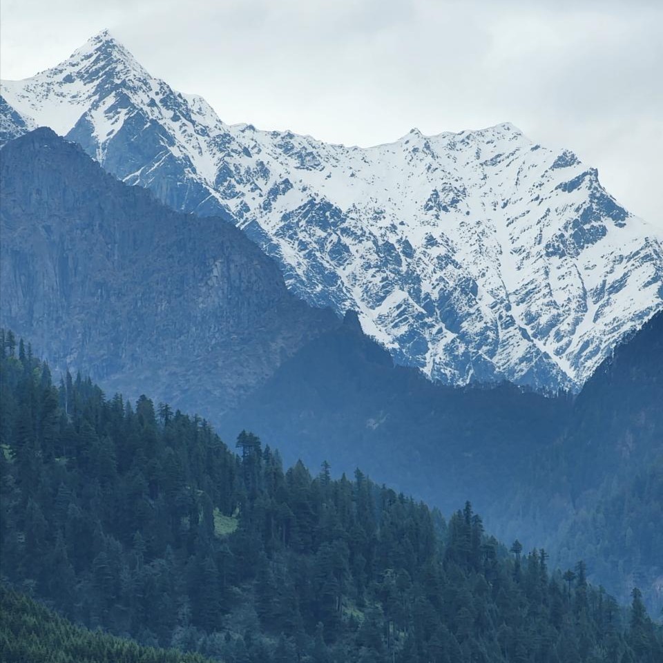
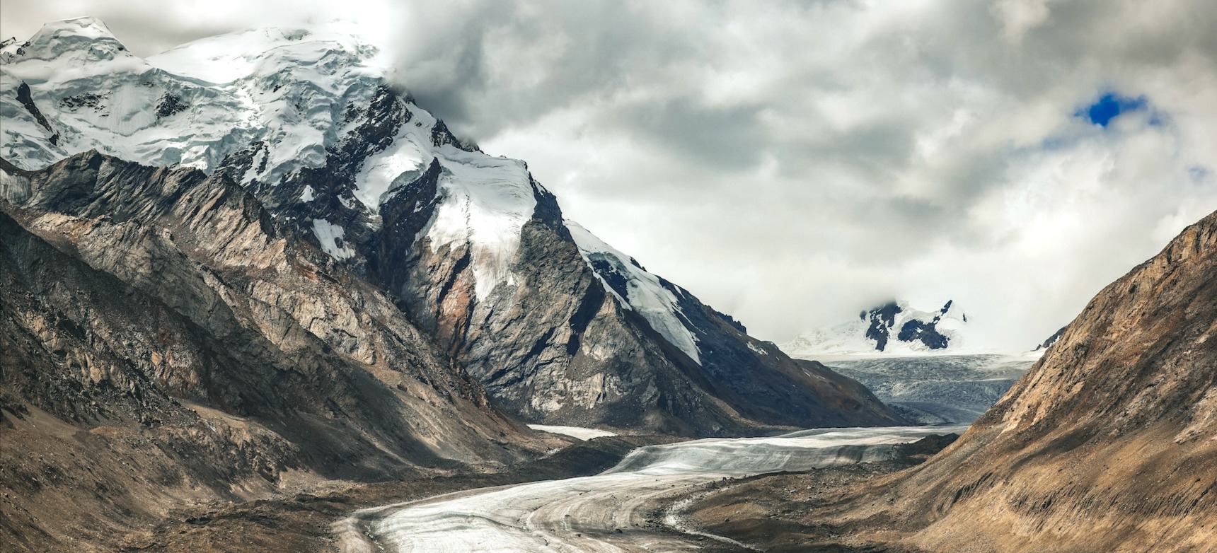
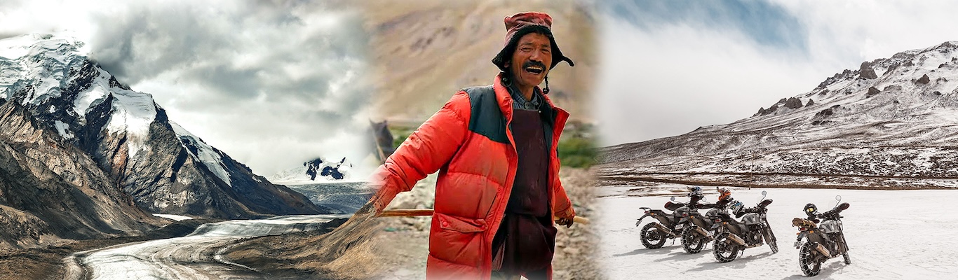
Experience amazing Zanskar in all its glory – deep in the heart of the Himalayas, in remote valleys that were till recently isolated from the outside world. A magical land once lost to time, finally open to the greater public today is a privilege to ride through. Witnessing the beauty of the area, the simplicity and spirituality of its people and the magical scenery will make your ride an adventure of a lifetime! From smooth tarmac to dirt roads, winding valleys and gorges along the flowing rivers, climbing and descending some of the highest mountain passes in the world - Zanskar has it all!
Itinerary
Start Early
The acclimatization day – a leisurely start post breakfast as we climb to the Atal Tunnel, a 9.2km long tunnel constructed at above 10,000 feet above sea level and a real marvel of modern day engineering. We turn off towards Gramphoo and begin a beautiful off-road section, one that will provide the group with a taste of some of the terrain to come in the following days. We ride till Chhatru, have lunch and return the way we came before heading on to Sissu – our halt for the day. This will also be a good night of acclimatization, as we shall spend the night at around 4100m above sea level.
Map
Start Early
We take the road from Sissu to Padum via Keylong, Darcha, Shingo La, Kargiak and Purne. Though the road has been largely tarred, the ride remains challenging with dirt stretches, bare-bones infrastructure along the route, the possibility of water/ice crossings and maybe even snow atop the 16,800 ft high pass – Shingo La – the Gateway to the Zanskar Valley. Further along the road we cross the holy mountain – Gombo Ronjon, and make our way past the village of Purne, before riding along the Tsarap river for much of the remainder of the day. We halt in the town of Padum for the night.
Map
Start Early
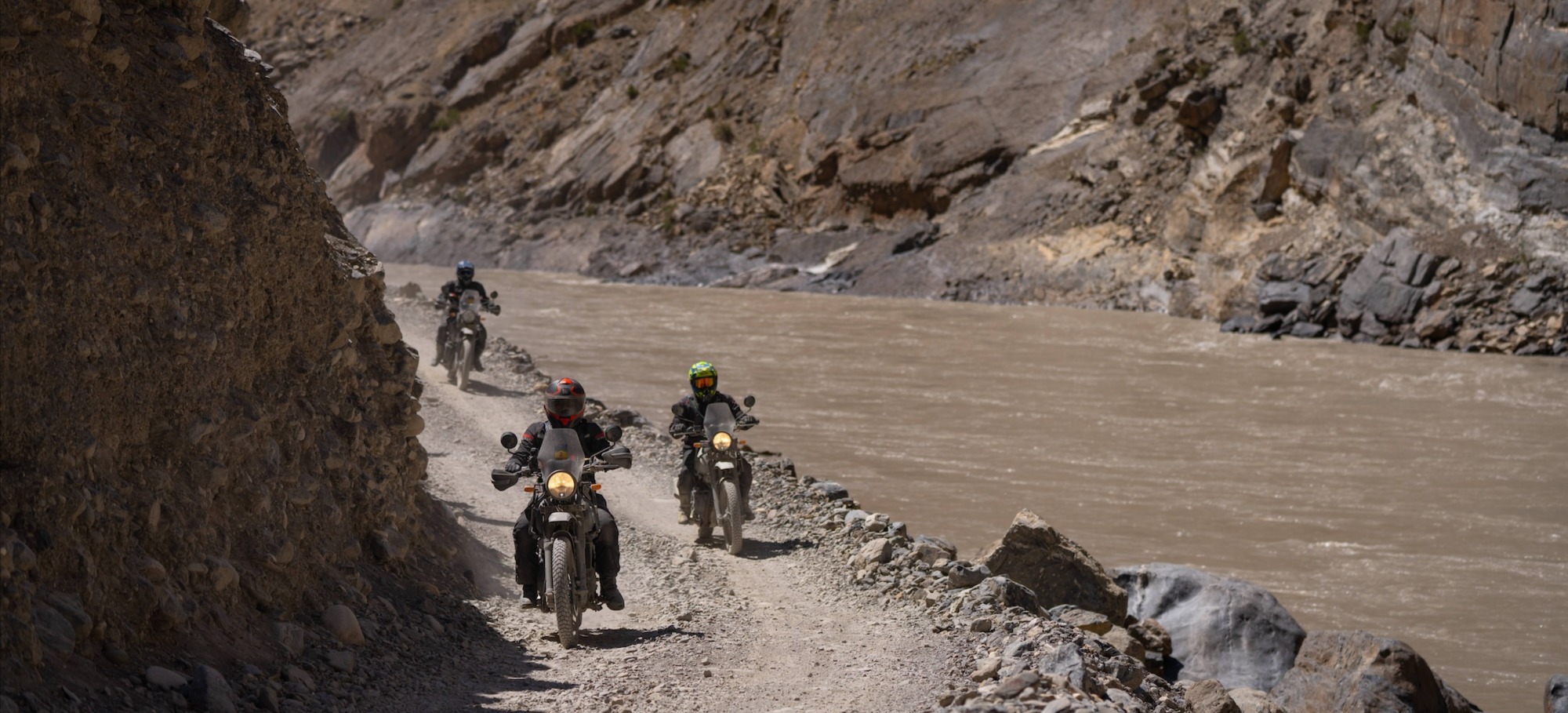
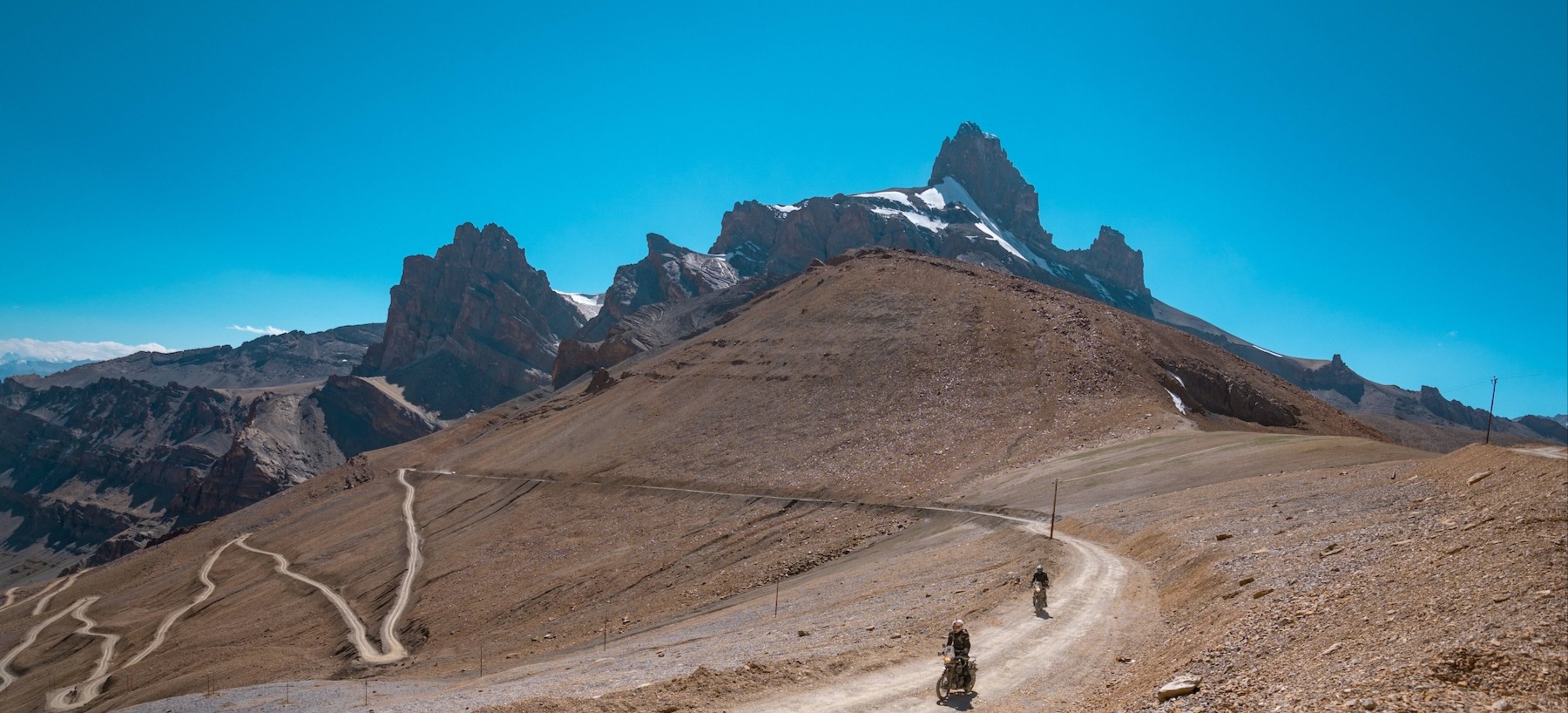
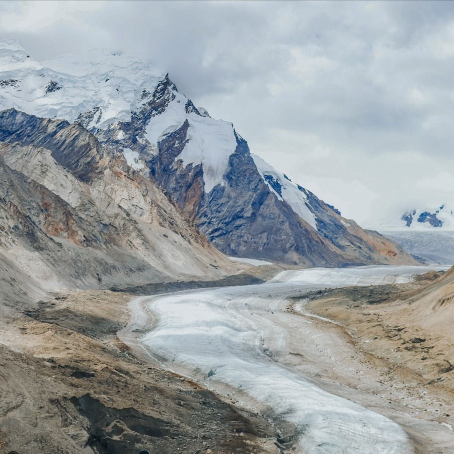
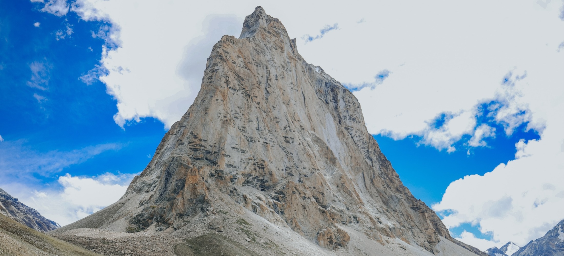
The group heads off towards Penzi La and the Drang Drung glacier – one of the most magnificent sights on this trip, as we witness the 17 km long glacier as it snakes down into the Stod river. The run to Kargil from Padum is almost completely smooth gravel and fast. An amazing track for honing your off-road skills. The roadworks in the region have already converted much of the dirt to tarmac, and one can be sure of a well-paced ride through some incredible vistas. We enter the Suru valley and follow the river for much of the remainder of the day, to Kargil, our halt for the night.
Map
Start Early
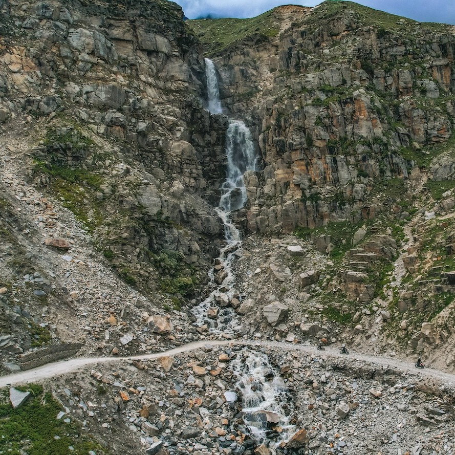
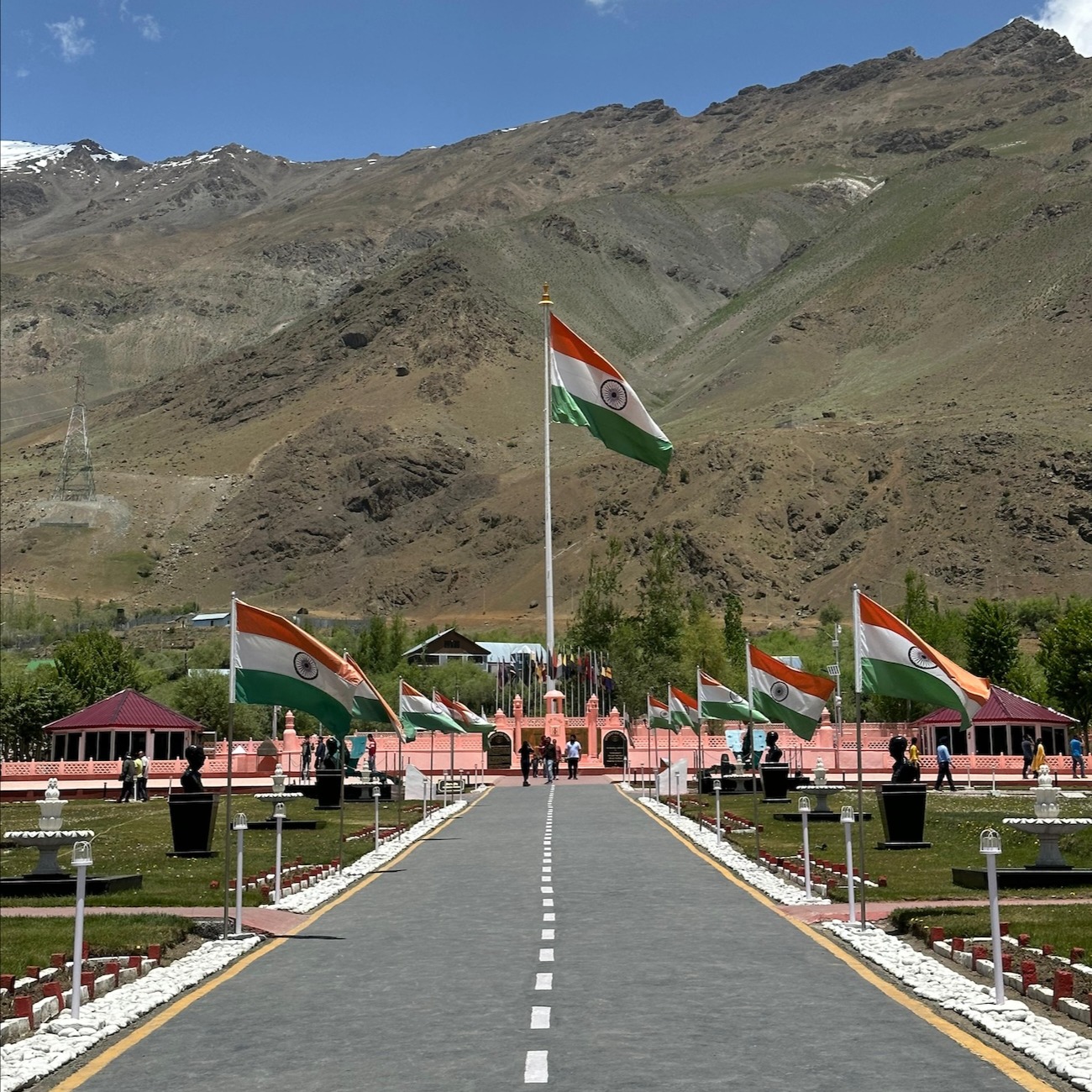
This day has two options. Those weary and in need of recuperation can do so. The local market can be explored later in the day. Those that have the restless energy of a true explorer shall head to the War Memorial at Drass, a site that truly captures the essence of many historic battles fought in and around the area. We will then cross the Umba La (around 15,000 feet above sea level), have lunch en route and return to Kargil for the night. A stunning ride that many who frequent the region are yet to experience, due to the relatively unknown nature of the route!
Map
Start Early
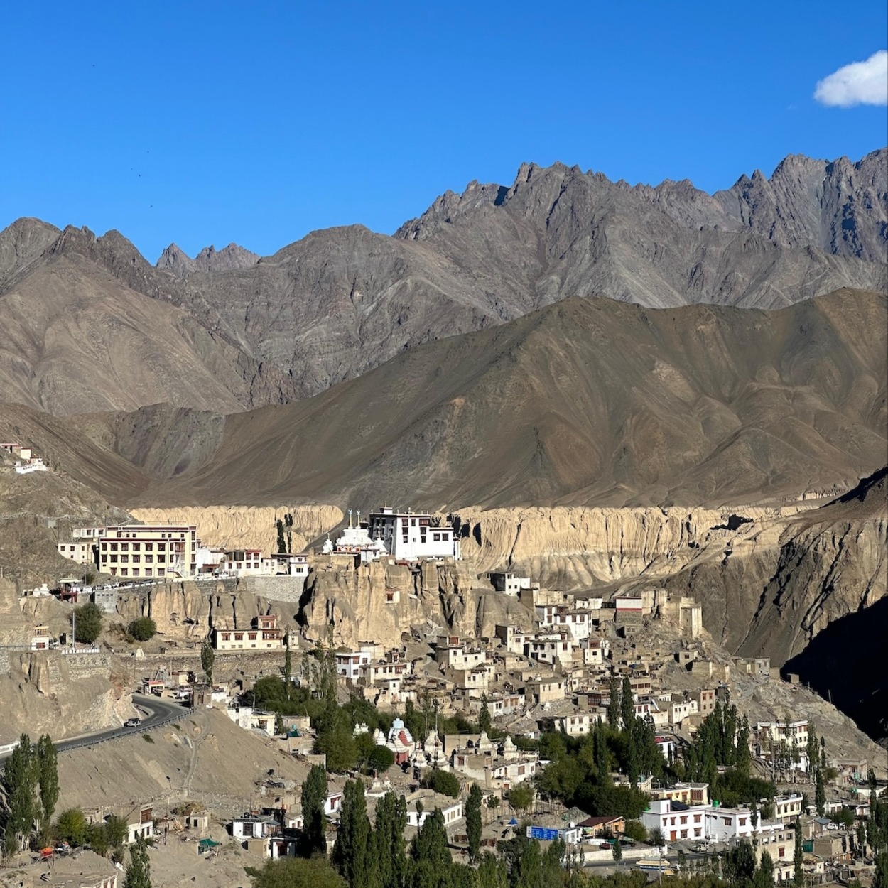
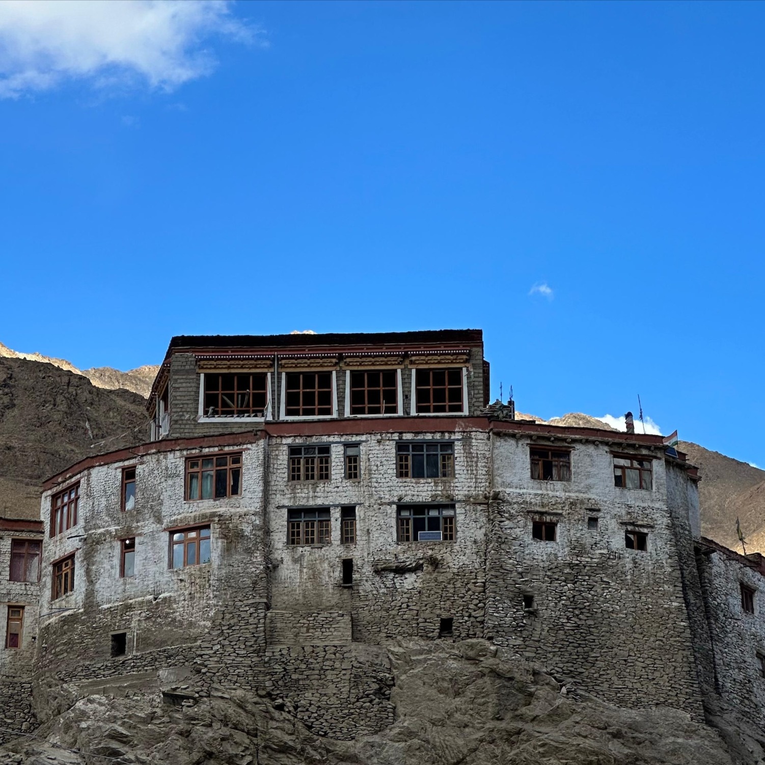
We head out post breakfast and head into the Batalik Sector, climbing to Humboting La (4056m above sea level). This area is seldom explored by mainstream tourists, and the ride is a serene one as a result. The views are stunning and very soon we surmount the Pass, from where one can see the neighbouring land of Pakistan, mere kilometres away. We continue down some backroads before rejoining the main highway, where we stop at Lamayuru for the evening. The town has a famous monastery and those interested can pay a visit to the same.
Map
Start Early
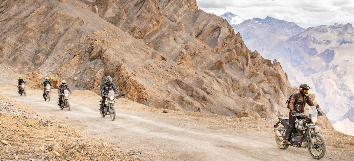
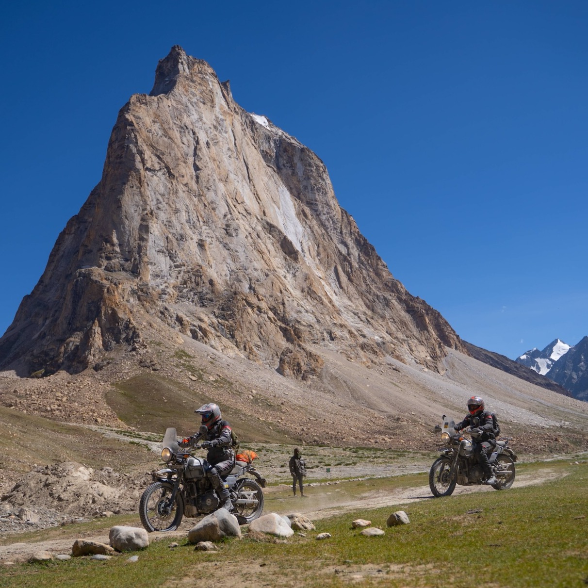
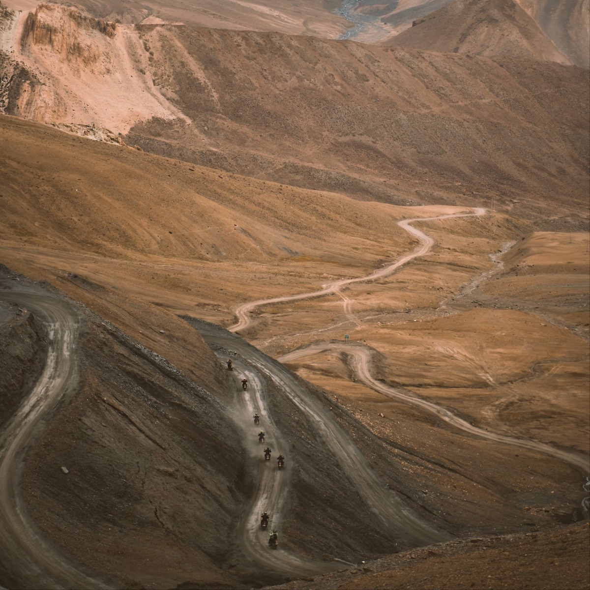
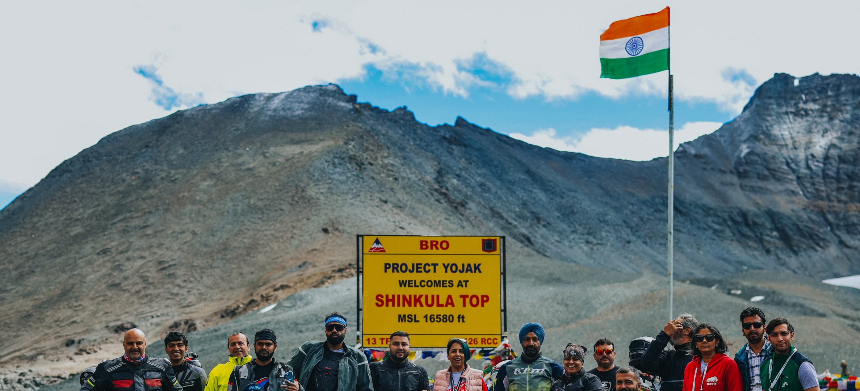
The most challenging day of the entire ride. We turn off the main highway before beginning the climb to Sirsir La (4804m). This road, once completely dirt, is being rapidly tarred and the climb to the top will be a fast paced one! We then descend for a short while before beginning the ascent to Singge La (4952m). The descent from here is long and unforgiving, with magnificent vistas greet us around every bend, and before long we find ourselves along the Zanskar river with the sun beginning to set – a truly surreal experience! Tarmac from onwards Zangla and Padum for the night - what a day!
Map
Start Early
A day off for you and your motorcycle! Riders are free to explore the quaint town of Padum, familiarise themselves with the local culture, visit the monastery and so on, or even just relax after the rigorous past few days of riding! Our team will spend the day carrying out any work required on the motorcycles.
Map
Start Early
An early start, as we ride along the Tsarap Chu and back to Purne and beyond. We cross Gombo Ronjon and summit Shingo La, and before long we are back into Himachal Pradesh. A few more hours on the smooth tarmac and back through the Atal Tunnel before descending to Manali – where we shall celebrate the end of a truly epic journey – one which would have changed you all forever!
Map
Start Early
Checkout post breakfast/ early departure depending on when everyone has their flights booked. Those who wish to extend their trip may enjoy the serenity of the hills for a few more days. The rest can avail of our airport transfer facility to Chandigarh!
Map
Highlights
Tour Guide
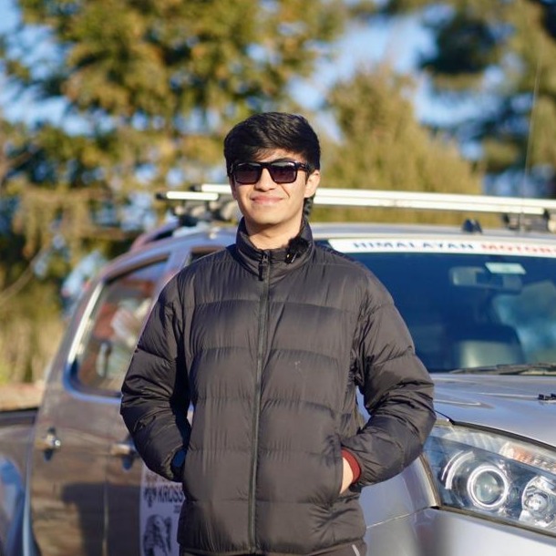
Arjun Parmar
Tour Guide
Language Spoken
English,Hindi
Experience
10 Years
Keep in Mind
- Riding Jacket
- Riding pants
- Full face DOT/ ECE helmet
- Riding boots (Adventure or MX)
- Riding gloves
- Reliable waterproof hiking shoes
- Rain Gear
- Personal medicines
- Sunscreen
- Waterproof Clothing
- Detailed list to be provided closer to the event
- Jacket
- Personal clothing for non-riding hours
-

Nearest Railway Station
Chandigarh -
Nearest Airport
Chandigarh
- Driver's License
- International Driving Permit
- Passport
- Travel Insurance
- Travel Permit for India
- Valid Personal Insurance Policy
- Valid Travel Insurance Policy
- Accommodation
- Airport/StationTransfer
- Breakfast
- Dinner
- Entry Fee for local visits
- First aid kit
- Fuel
- Gratuities / Tips
- Luggage Truck
- Lunch
- Mechanic
- Motorcycle Maintenance during the ride
- Permit Charges
- Toll Charges
- Water Bottles
- Tea/ refreshments en route on riding days
- Visa
- Alcoholic beverages
- Medical / Travel insurance
- Motorcycle Damage Cost in case of an accident
- Motorcycle Pick and transfer in case of a breakdown / accident
- Personal expenses such as Laundry / Snacks / Room service / tips etc
- Air tickets
- Anything not mentioned in the inclusions
Operated By:
Starting From
USD 2,800
*Price is subject to change.
Rentals Fleet
Reviews
No Reviews Available for this Tour


Get Operator Details
Enter First Name
Please enter a valid first name.
Enter Last Name
Please enter a valid last name.
Enter Mobile Number
Please enter a valid mobile number.
Please enter a valid email id.
Please enter a valid email id.
I have fully read, understood and agree with the User Agreement / Terms and Conditions of Use for the Platform. I fully understand and agree that Royal Enfield is acting only as an aggregator and shall in no way be responsible for loss / damages or injury arising out of services / deficiency in services offered by the third party Tour / Rental Partner(s) on the Platform. Further, I hereby expressly authorize Royal Enfield to share my Personal Information with the end third party Tour / Rental Partner whose services I have chosen.
I accept all the Terms & Conditions
Please select the terms and conditions.
